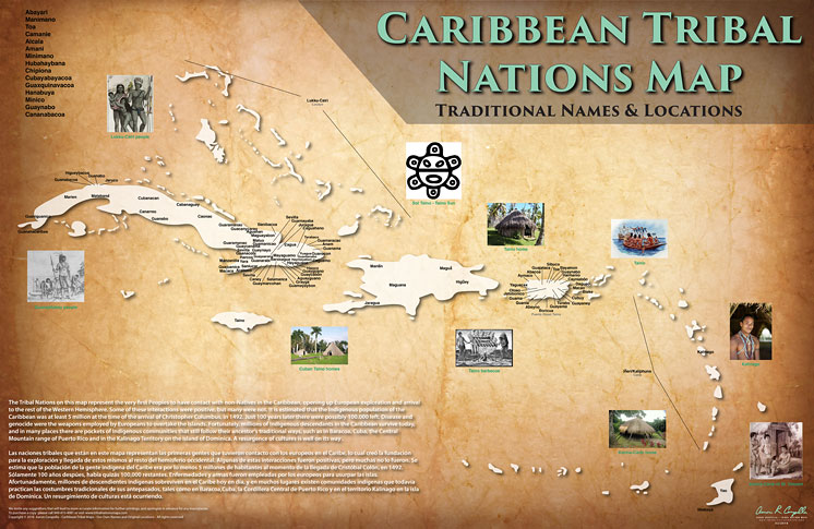
Stigler, OK, February 24, 2016: I have created a series of comprehensive Tribal maps, showing the largest number of Tribal Nations ever to be documented in the Western Hemisphere. They are also the only maps to detail traditional names that Tribes call themselves, in their own languages.
Introducing the new Caribbean Tribal Nations Map ! Ironically the last section of the Western Hemisphere that I have completed is of the first point of contact by Europeans (excluding the Viking arrival several hundred years earlier in eastern Canada).
This map is special to me because I briefly lived in Puerto Rico about 10 years ago and visited a lot of Taino villages and other historic sites. I have also had many Caribbean people ask me to do this map, because so much knowledge has been lost over time, although a large percentage of the island peoples are indigenous descendants.
This map marks my completion of mapping the entire “Americas.” I have traveled to roughly 300 Tribal communities, and to hundreds of museums, historic sites and Indigenous events for research. If you would like to do a story about my lifelong project to document a Native perspective of the Americas and it’s peoples, I am available at the contacts below. Thank you.
Aaron Carapella
Tribal Nations Maps
1103 NW pth St
Stigler, Oklahoma 74462
tribalnationsmap@gmail.com
Purchase your Tribal Nations Maps online:
www.tribalnationsmaps.com


